Successful Trip to Sacajawea Campground
On June 2, we traveled on Middle Piney Road to Sacajawea Campground in the Bridger Teton National Forest. The snow had significantly retreated since our last trip to this area.
On June 2, we traveled on Middle Piney Road to Sacajawea Campground in the Bridger Teton National Forest. The snow had significantly retreated since our last trip to this area.


-

-
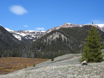
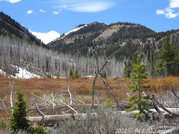
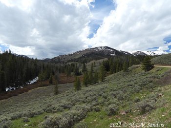
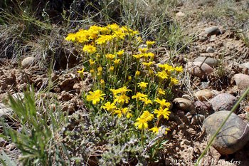
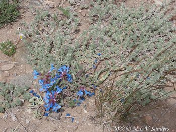
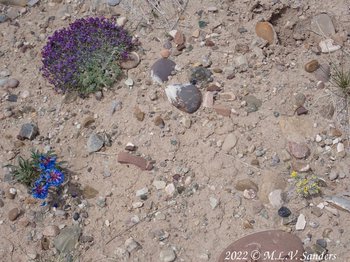
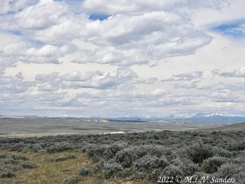
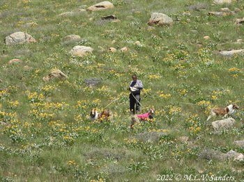
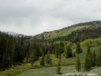
We turned onto an unnamed road leading to the nearby Straight Creek Trailhead. We pulled over to eat lunch and do some walking in the scenic area..
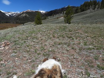
Sugar Boy at our lunch spot taking it all in.
Straight Creek flows through the dense brush below our lunch spot. Someone must have been joking around when they named this Straight Creek because it is the opposite. It snakes this way and that across the valley
The view from our lunch spot.
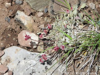
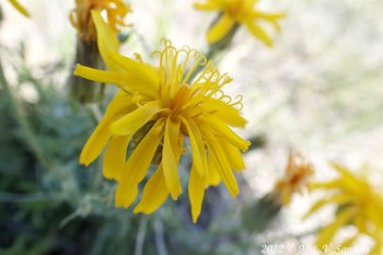
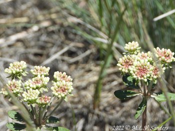
Pussytoes
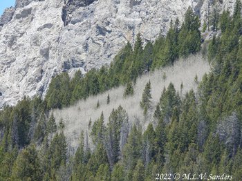
Velvety aspen on the hill side, before they have leaves.
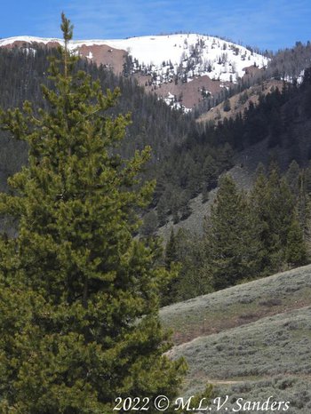
Looking the other way from our lunch spot, near the top of the hill, is a very large tree, perhaps an old limber pine. The shape of the tree is unusual, more like a round apple tree than a pine tree.
This old tree survived the 2012 Fontenelle Fire that claimed many of the dead trees on the hill side.
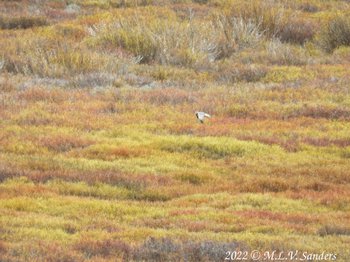
A Harrier hawk on one of its many flights over Straight Creek.

-
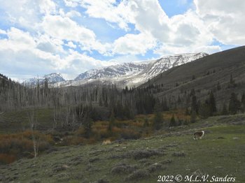
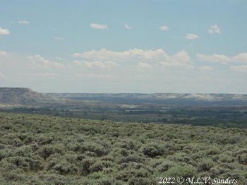
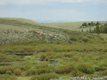
We drove through the Sacajawea Campground and stopped at one of the sites to look around. Three campsites were occupied, including the campground host.
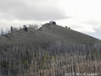
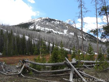
Looking away from the Sacajawea campground. The 2012 Fontenelle forest fire came very close to the campground and left the small forest of dead trees across the way.
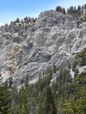
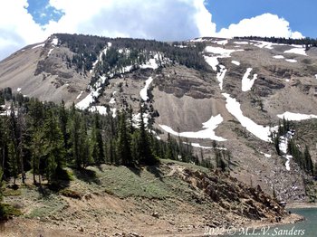
Steep bluff above Sacajawea Campground site #7.
An old wood fence along the edge of the campground.
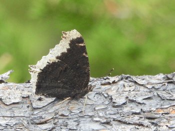
A Mourning Cloak butterfly with its wings up, looking at the underneath side of the wings.
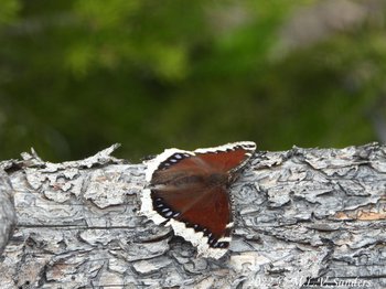
The same Mourning Cloak butterfly with its wings down.
Forest Service Road FS 10046 runs roughly parallel to the National Forest for a significant distance. To the north, the FS 10046 goes to the access road for McDougal Gap.

Forest Service road FS 10046 headed north from Middle Piney road is very scenic.
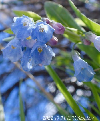
We pulled over at a wide spot in the road and found many flowers. Fish Creek Mountain is in the background. Our Honey Boy is in the lower right.
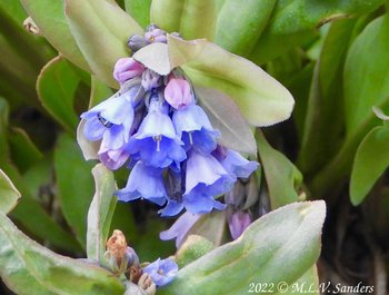
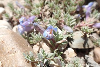
We call these flowers like this Mertensia when we aren't sure which species it is. I think they are Sagebrush Bluebells.
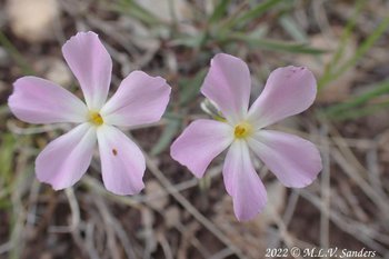
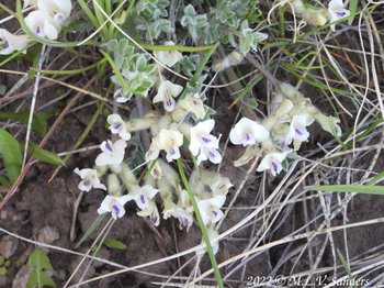
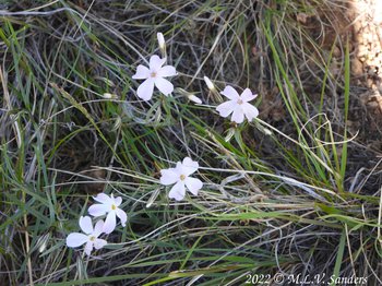
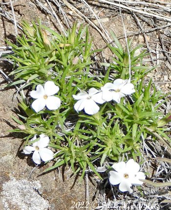
phlox
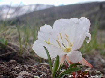
Tufted Evening Primrose
We live on a slightly over 2 acre lot on a moraine from the Bull Lake glaciation period. We have a yard only in the most generalized sense. There is lots of sagebrush, and no trees, but has rocks and a few boulders dropped by retreating glaciers probably over 100,000 years ago.
The snow covered mountain Sawtooth and neighborhood aspen trees.
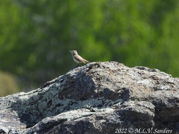
Sage Thrasher on a lichen covered granite boulder.
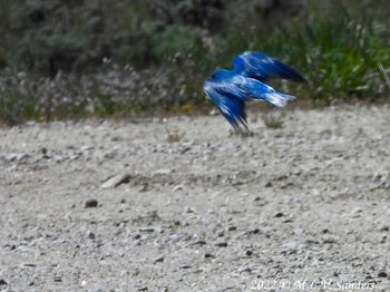
Mountain Bluebird flying away.
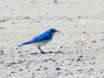
Mountain Bluebird in the driveway.
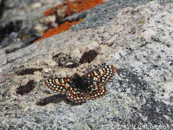
Edith's Checkerspot butterfly. I also saw a Western white and some sort of blue but was to slow with the camera.
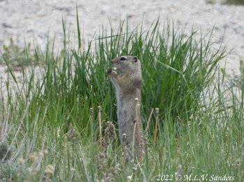
Wyoming Ground Squirrel
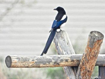
Magpie
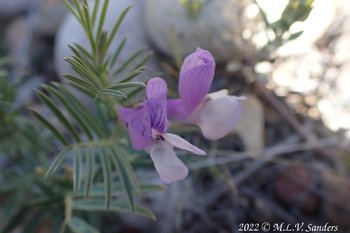
Plains Milkvetch- I discovered this outside our bedroom window, I hadn't seen it before this summer
Small dainty Longleaf Phlox.
I am not sure what this is. Reminds me of Queens Anne Lace.
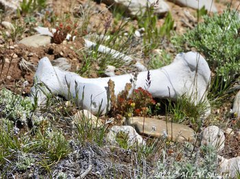
Small flowers with a bone we collected from the National Forest.
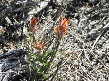
Paint Brush
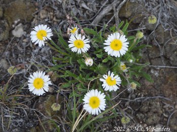
Cutleaf Daisy
Moss Phlox
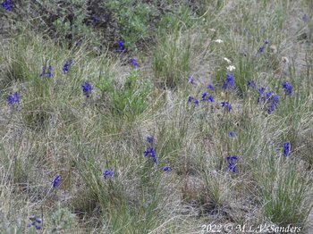
Larkspur
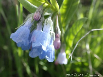
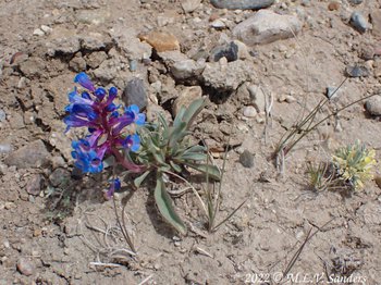
Sagebrush Bluebells
Sagebrush Bluebells
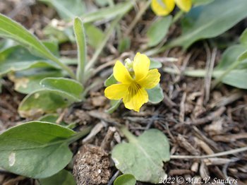
Nutall's Violet
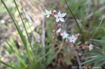
Small Flowered Wood Star
On the way to Soad Lake to walk the dogs and get out of the house on July 9, we turned off the main road and followed a side dirt road to Fremont Ridge. Fremont Ridge is a huge moraine on the south side of Fremont Lake.
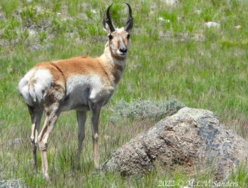
A brave (or foolish) photogenic pronghorn that stayed close to us and posed for the camera.
The same pronghorn keeping an eye on us.
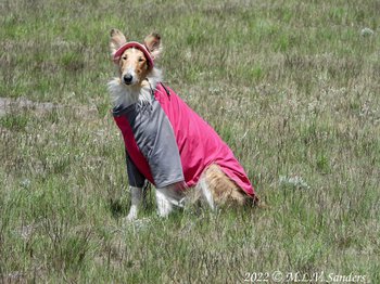
Our Honey girl with her fashionable hat and UV protecting sun-suit. Honey has a the medical condition Sebaceous adenitis that results in hair loss.
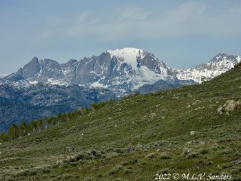
Fremont Peak with the much closer Fremont Ridge in the foreground. The name Fremont was popular here. Fremont Lake is on the other side of Fremont Ridge.
On June 10, we toke a drive over what the locals and old USGS topographic maps call "The Mesa". It's a very large and mostly flat surface south of and over 500 ft higher than the town of Pinedale Wyoming. We started our adventure over the Mesa by turning off of county road CR 136 (Paradise Road) onto the road BLM 5102 headed north.
We soon stopped for lunch, picture taking and a dog walk when our road crossed the Emigrant Trail. There is a marker there and well worn tracks of the Emigrant Trail. This trail is also called the Lander Cut-off of the Oregon Trail. There are good views and lots of flowers at this spot. The rocks laying on the ground are also very interesting. There are many different types and colors of rocks. What is strange is that many of the rocks are smooth and rounded as would be found in a stream bed.
That afternoon we followed BLM 5102 to the northern end of the Mesa.

Two young Wyoming Ground Squirrels
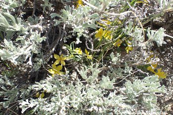
In the spring time there are numerous displays of flowers sometimes hidden by the sage brush..
Many-flowered Puccoon
We are not sure what these pretty things are.
Buff fleabane
Red flowers of some variety or another.
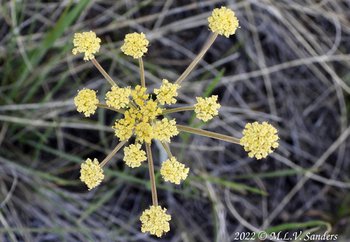
Yellow Flowers
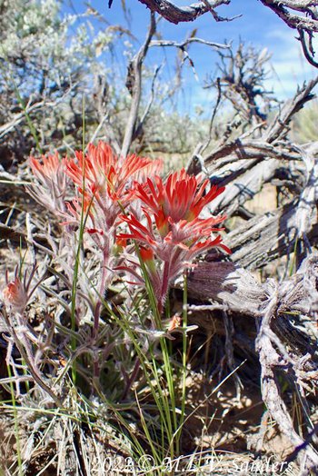
Paintbrush
Penstemon
Many-flowered Puccoon
More pretty yellow flowers. Notice the rounded worn stones that look like they were in a stream bed.
Purple and white flower.
Dusty Maiden
More white flowers.
A Penstemon on Stewart Point
A little garden.
Penstemon
On the Mesa, we are hundreds of feet above the valleys of the Green River and New Fork River. For the most part, our views are blocked only by the distant mountain ranges. The vast expanse of land that can be seen with a simple turn of the head is amazing.
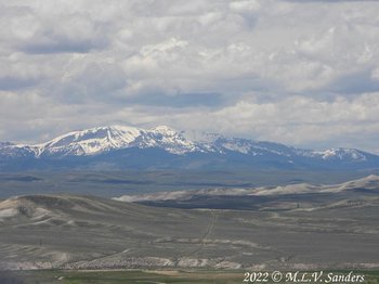
A view of the Wyoming Range from the Mesa.
A view of the Gros Ventre Mountains from the Mesa.
This is the view as we climb up the Mesa from the south on the road BLM 5102. Ross Butte is the high point on the left. In the valley below, the New Fork River merges with the Green River.
The Wyoming Range as seen from the Mesa. The Green River below has carved a wide valley.
A view of the Wind River Range.
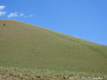
Just south of Half Moon Mountain is land owned by the Wyoming Game & Fish Commission. The dirt road that runs through this land and parallels the mountain is well maintained. We see a few trees at the top of the very steep Half Moon Mountain. The south side of the mountain is very steep, treeless, with numerous rocks and boulders. But today, the mountain had an unusual yellowish hue from the large numbers of blooming Arrowleaf Balsamroot.
The Arrowleaf Balsamroot are blooming now. I found two plants in my back yard. I would love it if they spread like they have on the south side of Half Moon Mountain
Yellow flowers of the blooming Arrowleaf Balsamroot color the south side of Half Moon Mountain.
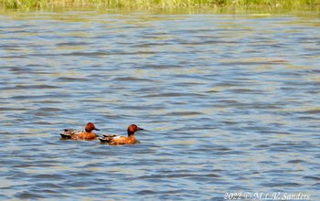
We went out some way back roads to the base of Half Moon Mountain. It was a deserted, quiet, cloudless day. Here are two male Cinnamon Teal we saw in a stock pond on our way there
Collieflowers!
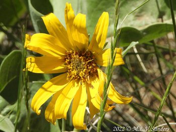
Here is what an Arrowleaf Balsamroot looks like close up.
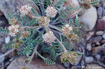
Sulphur Buckwheat
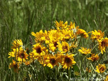
More Arrowleaf Balsam Root
6-18-22-- Back to the southern Wyoming Range for the third time this year. We have been wanting to visit Middle Piney Lake for 4 years! It has been closed for repairs to its dam. In honor of Father's Day the Forest Service opened the lake for the weekend. It was worth the wait. We entered the Bridger-Teton National Forest on Middle Piney Road.
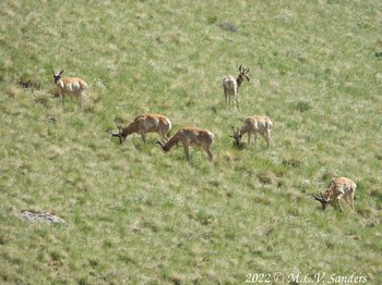
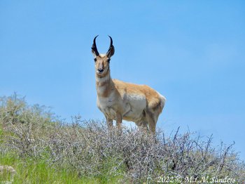
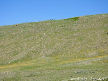
A group of pronghorn overlooking the snowmobile (not the official name) parking lot at the National Forest entrance.
Here is another picture of the pronghorn that were in the first picture. The pronghorn are the small dots on the right side if the picture close to the sky.
Its mid-June and there is still snow on the shores of Middle Piney Lake at 8841 ft elevation. Around the dam there were many shovels, rollers, front end loaders, and building materials for repairing the dam. I don't know how they got all those things up the narrow dirt road that leads to the lake.
We spoke to a Forest Service ranger at the dam. She told us the lake would be closed through July to allow work on the dam to continue. The lake is to open to the public in August for some uses such as fishing while work on the dam continues. We also asked the ranger about the status of road FS 10046 that runs north-south inside the National Forest boundary and were told it was in good condition.
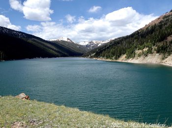
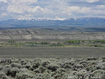
Middle Piney Lake with Wyoming Peak and Coffin Peak in the background.
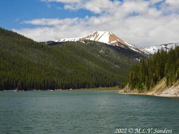
The far end of Middle Piney Lake.
The side of Fish Creek mountain that looks over Middle Piney Lake.
After lunch, we got on road FS 10046 headed north. Our goal was to make our way to North Cottonwood road, which would allow us to either head to either Mcdougal Gap or return to civilization.
Before heading off on FS 10046, we stopped above the Sacajawea Campground for lunch
We are driving north on Foerst Service road FS 10046, vaguely headed toward home.
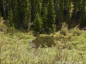
A beaver pond with a visible dam on Edwards Creek.
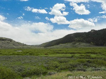
North Piney Creek valley is very broad and open.

North Piney Creek in the foreground, Mount Schidler in the background.
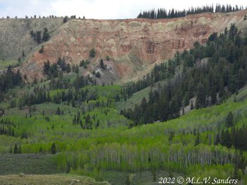
We saw this large, high, red, and white cliff when parked near the bridge over North Piney Creek.
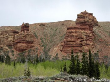
We had been driving through a pine forest when we went around a corner and saw this, the Red Castles. What a surprise!
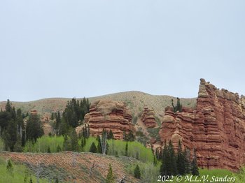
More red rocks, carved by the wind.
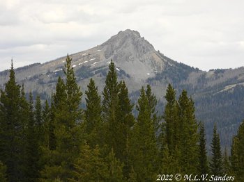
Lander Peak.
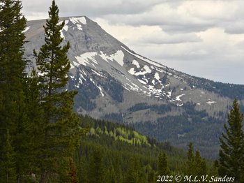
Triple Peak.
North Cottonwood Creek and the Wind River Range. We made it!
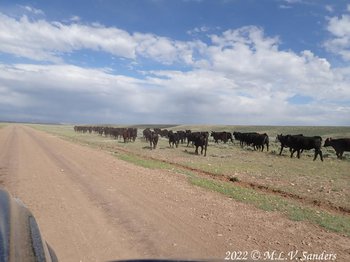
On the way hone these young ladies were completely blocking the road. There is always something interesting out here!
We had been gone all day looking at Middle Piney Lake and driving around the area finding spots to go back to later for more detailed exploration. When we got back home we had no cell phone service, land line, or internet. It's weird to be cut off from the world like that.
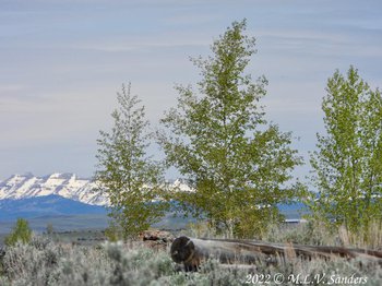
After spending the morning in Jackson taking care of life we decided to avoid the crowds at Grand Teton National Park and head out to the National Elk Refuge. At this time of year the elk are someplace else but we still saw lots of wonderful things.


